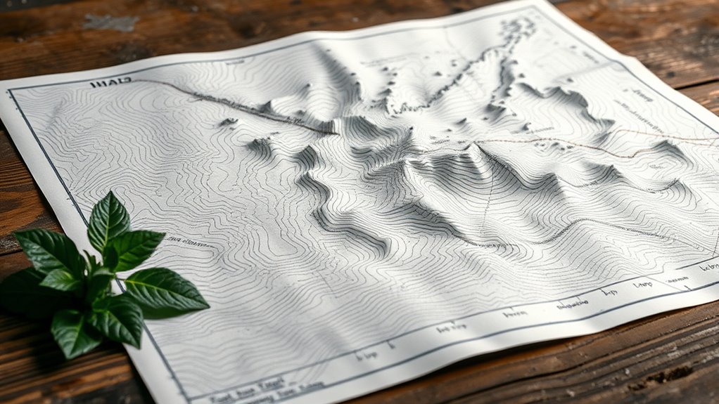

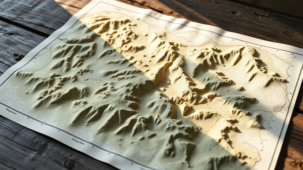
To spot moisture-rich areas on topographic maps, look for gentle, broad curves indicating flat, moist land like valleys and drainage zones. Pay attention to contour lines—tightly packed lines show steep slopes, less likely to hold resources, while wider spaced lines suggest gentler slopes with more water retention. Recognizing these features helps you find the best spots for foraging, and if you keep exploring, you’ll uncover even more ways to interpret these natural signals.
Key Takeaways
- Contour lines indicate land slope, helping foragers identify steep, less resourceful areas versus gentle, moisture-rich zones.
- Tightly packed contours signify steep slopes; wider spacing suggests flatter areas with better moisture retention.
- Valleys and drainage points, shown by V-shaped or U-shaped contours, are key moisture and resource hotspots.
- Recognizing landforms guides efficient route planning, conserving energy while accessing abundant foraging environments.
- Understanding topography aligns with ecological cues, supporting sustainable harvesting and respectful land use.
If you’re foraging in unfamiliar terrain, topographic maps are essential tools that can make your search safer and more efficient. They unlock the secrets of the land, revealing details about the terrain’s shape and environment that help you navigate with confidence. When it comes to indigenous navigation, these maps echo ancient wisdom, allowing you to understand environmental patterns that have guided people long before modern tools existed. By studying contour lines, you gain insights into the land’s natural flow—knowing where valleys dip and ridges rise gives you the advantage of moving through the landscape with purpose and awareness.
Understanding environmental patterns, such as how water flows and where moisture accumulates, is vital for successful foraging. Topographic maps show you the subtle cues that indicate moisture-rich zones—valleys, low-lying areas, and natural drainage points where water gathers. These are often the most fruitful spots for finding edible plants or game, as they tend to support lush growth and attract wildlife. Recognizing these patterns allows you to predict where resources are likely to be, even in unfamiliar surroundings, empowering you to forage more effectively and sustainably. Additionally, interpreting topographic features enhances your ability to identify safe and efficient routes through diverse terrains.
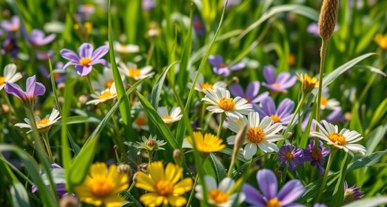
Moisture-rich zones like valleys and drainage points are prime spots for abundant foraging and wildlife.
Reading contours isn’t just about lines on a map; it’s about interpreting the story they tell. When you see tightly packed lines, you’re looking at steep slopes that are less accessible and less likely to harbor abundant plant life. Conversely, gentle curves suggest flatter areas that tend to hold more moisture and support thriving ecosystems. By intuitively linking these features to environmental patterns, you can chart a route that maximizes your resource encounters while conserving your energy. This approach aligns with the wisdom of indigenous navigation, which emphasizes harmony with natural land cues and ecological rhythms.
Your ability to read topographic maps allows you to move fluidly through the land, respecting its natural contours and patterns. It’s about emancipation—breaking free from reliance on technology and reconnecting with the land’s innate signals. As you study the curves and features, you tune into the landscape’s subtle language, making your foraging journeys more intuitive and respectful of the environment. This knowledge transforms your exploration from mere wandering into a focused, mindful adventure that honors the land’s wisdom and guarantees your survival and abundance.
Frequently Asked Questions
How Can I Identify Water Sources on a Topographic Map?
You can identify water sources on a topographic map by looking for areas where water flow naturally concentrates, such as valleys and low points. Watch for contour lines that form V-shapes pointing uphill, indicating stream paths. Moisture patterns often show as darker or shaded zones near these features. Follow the flow of water downhill, and you’ll find reliable sources—perfect for foraging and embracing your freedom in the wild.
What Map Symbols Indicate Different Types of Vegetation?
Vegetation symbols on a map reveal tree cover, shrubs, and grasslands, guiding your exploration. Look for green areas and tree symbols that indicate dense forest or sparse woodland, giving you the freedom to navigate and forage with confidence. Recognize the symbols representing different vegetation types to understand the landscape’s richness. Use these symbols to disclose nature’s secrets, empowering your journey and connecting you deeply with your environment.
How Do Seasonal Changes Affect Topographic Map Reading?
Seasonal changes greatly impact topographic map reading by altering visible features like seasonal vegetation and terrain variability. You’ll notice shifts in moisture levels, water flow, and plant cover, which can change terrain appearance. Stay alert to these variations, as they influence navigation and foraging. By understanding how seasons transform the landscape, you gain the freedom to adapt your route, making your exploration more intuitive and successful.
Are There Digital Tools to Help Interpret Contour Lines?
You can definitely count on digital map apps and contour analysis tools to help interpret contour lines. These tools take the guesswork out of reading topography, giving you clear, real-time insights that make navigation a breeze. With just a tap, you gain the power to understand terrain features and moisture patterns, freeing you from traditional constraints. Embrace technology—they’re your key to reading the land like a pro and exploring with confidence.
How Can I Determine the Best Foraging Locations Using Moisture Data?
You can determine the best foraging spots by analyzing soil moisture levels, which directly impact plant health. Look for areas on your map with ideal moisture—neither too dry nor too waterlogged—often indicated by specific contour patterns. These zones support vibrant plant growth, making them ideal for foraging. Trust your observations, combine moisture data with topography, and you’ll uncover hidden treasures that thrive in the perfect balance of water and soil.
Conclusion
By now, you might believe that reading contours and moisture on topographic maps is just a skill, but it’s actually a powerful tool for foragers. Some say these maps reveal hidden water sources and safe paths, making foraging safer and more efficient. While not foolproof, understanding these details could markedly improve your success rate. So, next time you explore, trust your map’s secrets—your foraging adventure might just change forever.