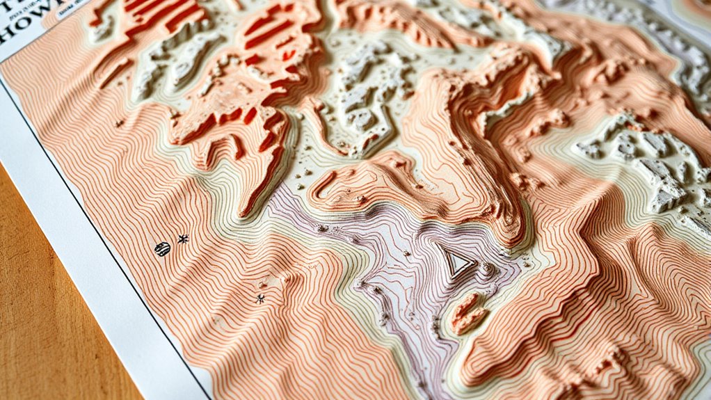
To navigate effectively, focus on the contour lines to identify steep slopes, valleys, and ridges. Closely spaced lines mean steep terrain, while wider gaps indicate gentle slopes. Look for low areas and streambeds, which usually hold moisture and support lush plant life. Recognizing these features helps you find water sources and prime foraging spots. If you keep exploring, you’ll discover how to interpret terrain features and moisture patterns for successful foraging.
Key Takeaways
- Contour lines show elevation changes; close lines indicate steep slopes, wider gaps suggest gentle terrain, aiding navigation and foraging.
- Recognize valleys and ridges from contours to locate water sources and wildlife habitats for sustainable foraging.
- Moisture-rich areas are often in low-lying zones or streambeds, identifiable through terrain features and lush vegetation patterns.
- Use topographic features like ridgelines and streambeds to plan efficient routes and access prime foraging locations.
- Reading contours and moisture patterns enhances navigation skills, helping foragers find food, water, and safe pathways independently.
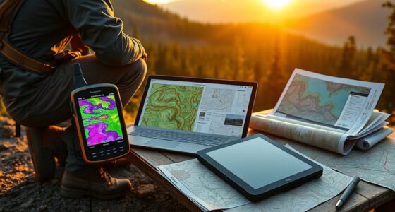
Topographic maps are essential tools for foragers, helping you navigate unfamiliar terrain with confidence. When you’re out seeking wild edibles, understanding the land through these maps unlocks the secrets of wildlife habitats and guides your navigation techniques. By reading contours and recognizing moisture patterns, you can find the richest areas teeming with life, making your foraging more successful and freeing you from dependence on external guides or technology.
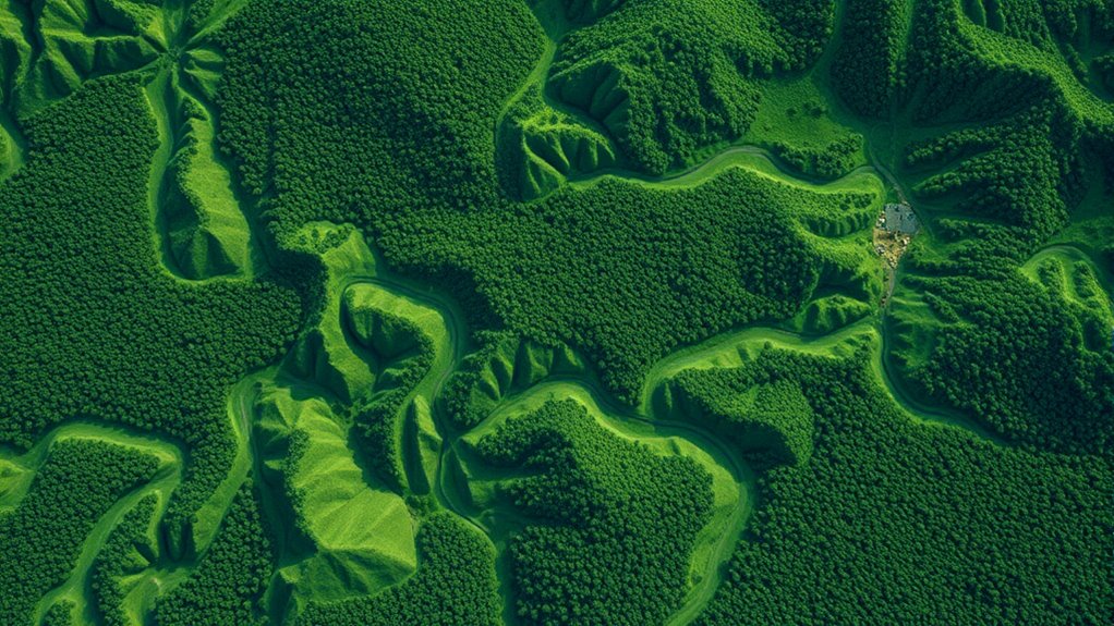
Your first step is to interpret the contour lines that snake across the map. These lines represent elevation changes, revealing the shape of the land. Closely spaced contours indicate steep slopes, while wider gaps suggest gentle inclines or flat areas. When you spot valleys and ridges, you gain insight into wildlife habitats, as many animals prefer specific terrain features. For example, animals often gather near water sources, which are typically found in low-lying areas or along streambeds. Recognizing these features on a topographic map allows you to target locations where plants are likely to thrive and animals are more active, giving you a strategic advantage.
Navigation techniques become more intuitive once you understand how to read these maps. Use the contours to identify natural pathways—such as ridges or valleys—that can lead you toward water, shelter, or food sources. Moving along ridgelines can keep you above dense brush and help you maintain a steady course, especially in unfamiliar terrain. Conversely, following streambeds or low-lying areas can lead you to lush patches of edible plants that thrive in moist soil. Remember, moisture patterns are often indicated by specific symbols or terrain features, but a keen eye and understanding of the landscape help you spot these clues. These moisture-rich zones usually support a diverse range of flora and fauna, making them prime foraging spots. Additionally, understanding how to read elevation changes on the map enhances your ability to navigate varied terrains effectively.
As you become more adept at reading the land through topographic maps, you’ll develop a sense of liberation—no longer confined by reliance on technology or others’ directions. Instead, you’ll trust your understanding of wildlife habitats and navigation techniques to explore confidently. By paying attention to the contours and moisture indicators, you can craft a mental map of the terrain, anticipate where the best foraging opportunities lie, and move through the landscape with purpose. This knowledge empowers you to forage sustainably, respecting the environment while maximizing your harvest, all while embracing your independence and deepening your connection to the land.
Frequently Asked Questions
How Can Contour Maps Help Identify Edible Plant Locations?
Contour maps help you locate edible plants by revealing areas with higher plant density, often where water and nutrients gather. Look for gentle slopes or valleys where moisture is retained, matching plants’ shade preferences. These maps guide you to spots with best growing conditions, empowering you to forage confidently and freely, knowing you’re targeting the most fruitful areas based on natural terrain features.
What Symbols Indicate Water Sources on Topographic Maps?
Water symbols and water indicators on topographic maps are your key to finding fresh sources. Look for blue lines labeled as streams, rivers, or creeks, and symbols like small blue circles for springs. Wetlands are often marked with shaded areas or marsh symbols. Recognize these water symbols to navigate confidently and access essential hydration sources, empowering your foraging journey and freeing you to explore nature’s abundance with certainty.
How Do Elevation Changes Affect Foraging Strategies?
Elevation changes dramatically shape your foraging game, turning hills into natural barriers or secret pathways. You’ll see soil erosion carve new routes, revealing hidden patches and influencing wildlife movement. By reading contours, you can exploit these shifts, seeking moisture-rich spots in valleys or escaping hazards on slopes. Embrace the wild landscape’s chaos, using elevation to your advantage, and break free from predictable foraging—your liberation lies in mastering these natural clues.
Are There Digital Tools for Reading Topographic Maps Easily?
Yes, digital map tools and contour reading apps make exploring topographic maps easier and more liberating. You can quickly identify elevation changes, water sources, and terrain features on your device. These tools simplify contour reading, helping you plan foraging routes efficiently. With user-friendly interfaces and real-time updates, you gain the freedom to navigate unfamiliar landscapes confidently, revealing nature’s bounty with less hassle and more adventure.
How Often Do Contour Lines Accurately Reflect Ground Moisture?
Contour lines can be a map’s heartbeat, revealing soil moisture with surprising accuracy, but they’re not foolproof. Typically, they reflect ground moisture when terrain features are consistent and the contour intervals are fine enough to show subtle changes. So, you should see moisture patterns more clearly in detailed maps, yet remain aware of their limits—nature’s unpredictable dance often outpaces the map’s lines, reminding you to trust your instincts.
Conclusion
By mastering topographic maps, you unseal nature’s hidden language, revealing contours and moisture that guide your foraging journey. Like a seasoned explorer reading the Earth’s quiet whispers, you gain insight into where abundance lies. Remember, these maps aren’t just lines on paper—they’re the keys to understanding your environment’s secrets. With keen eyes and practiced hands, you become part of the landscape’s story, turning knowledge into your most trusted compass in the wild.