
You should use GPS handhelds for quick, precise location data and easy route planning, especially in familiar or accessible areas. However, relying solely on them isn’t foolproof because signals can drop in dense forests, urban environments, or bad weather, potentially leading to errors. Traditional navigation skills like map reading and recognizing landmarks are essential backup methods that boost your safety and confidence. Keep exploring to discover how combining both approaches makes you a more prepared and resilient navigator.
Key Takeaways
- GPS handhelds offer quick, accurate positioning but can be unreliable during signal disruptions or bad weather.
- Traditional navigation skills enable terrain understanding and backup when electronic devices fail.
- Combining GPS and manual map reading creates a versatile, resilient navigation approach for diverse environments.
- Manual skills develop broader spatial awareness and confidence beyond technology dependence.
- Relying solely on GPS may risk safety; proficiency in traditional navigation ensures preparedness in all scenarios.
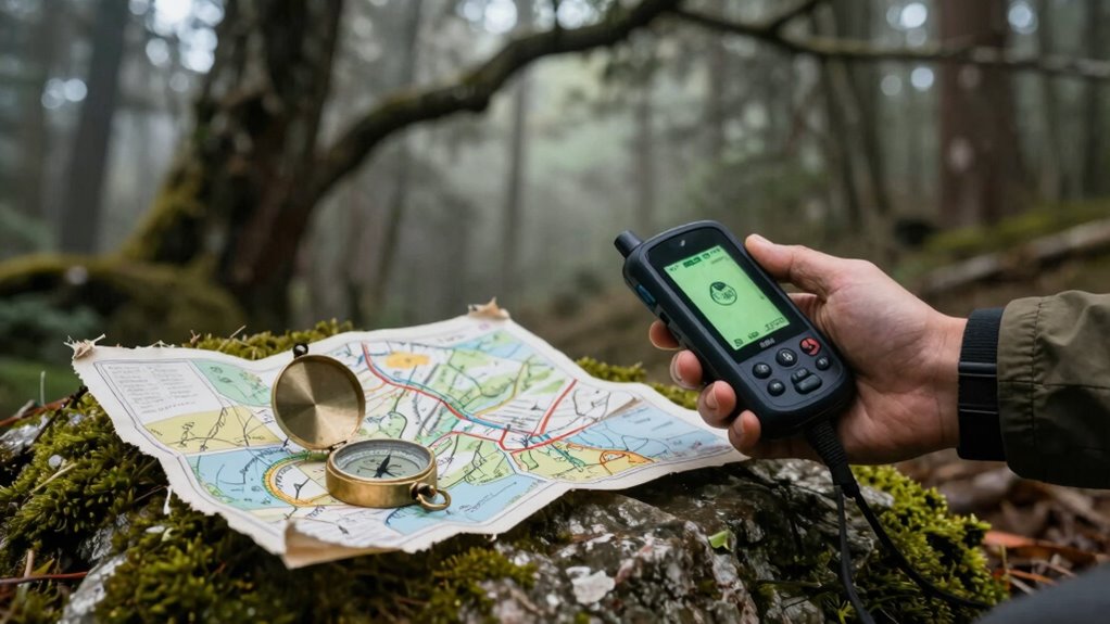
In today’s digital age, GPS handheld devices have become the go-to tool for navigation, but relying solely on technology can sometimes overshadow traditional skills that have guided explorers for centuries. While GPS units offer impressive satellite accuracy, they’re not infallible. Factors like dense forest cover, tall buildings, or bad weather can disrupt satellite signals, leaving you temporarily lost or disoriented. That’s where manual map reading comes into play. Knowing how to interpret topographical maps, identify landmarks, and use a compass can help you navigate confidently even when your GPS fails.
GPS is reliable but can fail—knowing traditional navigation skills keeps you safe and confident in any environment.
Satellite accuracy has improved dramatically over the years, making GPS devices incredibly reliable in most situations. They can pinpoint your location within a few meters, which is a huge advantage for quick decision-making. However, this precision can be deceptive. When signals drop or become inaccurate, you might find yourself misled if you don’t understand the fundamentals of traditional navigation. Manual map reading, on the other hand, relies on your ability to interpret physical maps, understanding symbols, scales, and contours. It encourages you to develop a broader sense of spatial awareness that isn’t dependent on technology. Additionally, understanding how to read topographical maps enhances your ability to navigate complex terrains more effectively. Recognizing landmarks and understanding terrain features are fundamental skills that can guide you when electronic devices are unreliable.
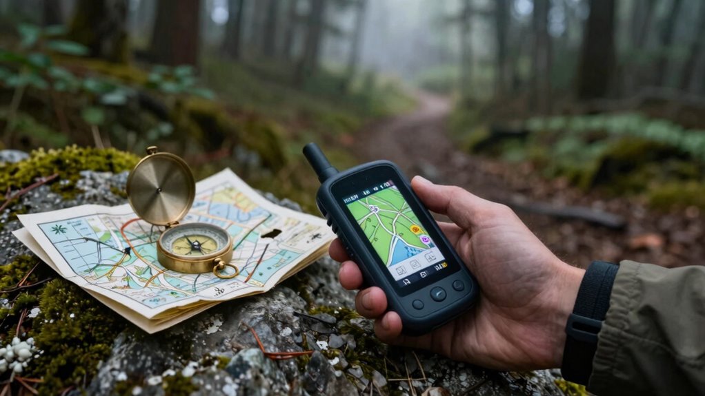
You should consider that GPS devices are excellent for quick, on-the-go navigation, especially when you’re unfamiliar with an area. They can save you time and reduce stress, but they shouldn’t replace foundational skills. Learning to read a map and use a compass gives you a backup plan that’s independent of battery life or signal strength. When you combine your understanding of manual map reading with the satellite accuracy of GPS, you create a well-rounded navigation toolkit. This approach ensures you’re prepared for various scenarios, from urban environments with signal interference to remote wilderness areas. Developing these traditional navigation skills**** can greatly increase your confidence and safety in unpredictable conditions.
Furthermore, practicing navigation techniques regularly helps reinforce your understanding and makes you more adaptable in real-world situations. In practice, you might start your journey using your GPS to get an overview of your route. As you go, keep your physical map handy, and practice verifying your position by correlating features on the map with real-world landmarks. This habit not only enhances your navigation skills but also boosts your confidence, knowing you can rely on traditional methods if technology fails. Regular practice and familiarity with terrain features make a significant difference in your ability to adapt when technology is compromised. Ultimately, mastering both satellite-based accuracy and manual map reading makes you a more versatile and resilient navigator, capable of tackling any environment with clarity and assurance.

Garmin 010-02256-00 eTrex 22x, Rugged Handheld GPS Navigator, Black/Navy
- Reliable Handheld GPS: Explore confidently with this device
- Sunlight-Readable Display: 2.2-inch color screen with 240×320 pixels
- Preloaded Topo Maps: Includes routable roads and trails for outdoor activities
As an affiliate, we earn on qualifying purchases.
As an affiliate, we earn on qualifying purchases.
Frequently Asked Questions
How Do GPS Handhelds Perform in Remote Areas Without Signal?
In remote areas without signal, GPS handhelds rely on preloaded satellite data, so you can still navigate even when there’s satellite connectivity or signal loss. However, their performance drops if the device hasn’t stored enough map information beforehand. You won’t get real-time updates, but your device can still guide you using stored data. Make sure to download maps in advance to avoid issues when signal loss occurs.
What Are the Cost Differences Between GPS Devices and Traditional Tools?
You’ll find that GPS devices cost between $100 and $500, depending on features, while traditional tools like compasses and maps often cost less than $50. The cost comparison shows that device affordability varies widely, but many find the added convenience worth the investment. Curiously, a basic GPS can be more affordable than professional-grade traditional navigation tools, making modern tech accessible without breaking the bank.
Can Traditional Navigation Skills Be Fully Replaced by GPS?
Traditional navigation skills can’t be fully replaced by GPS. While GPS devices offer quick, accurate positioning, skills like map reading and compass navigation are crucial in emergencies or when batteries die. You need to understand terrain and orient yourself without electronic aids. Practicing these skills ensures you stay safe, confident, and self-reliant in any situation, making traditional navigation a necessary complement to GPS technology.
How Durable Are GPS Handhelds in Extreme Weather Conditions?
GPS handhelds are generally quite durable in extreme weather, thanks to weather-resistant designs. You’ll find many models with robust construction that resist rain, snow, and dust. However, battery life can be affected by cold temperatures, causing the device to drain faster. To guarantee reliability, carry spare batteries or a portable power source, especially in harsh conditions. Properly choosing a rugged, weather-resistant GPS will keep you steering safely, no matter the weather.
What Training Is Needed to Effectively Use GPS Devices?
You need basic training in map reading and compass skills to effectively use GPS devices. Coincidentally, understanding traditional navigation techniques enhances your ability to troubleshoot and interpret GPS data. Start with familiarizing yourself with device functions, then practice plotting routes on maps. Regularly practicing these skills builds confidence, ensuring you’re prepared for situations where GPS signals might fail or when traditional navigation becomes necessary.
Conclusion
While GPS handhelds offer convenience, studies show that only about 35% of hikers can navigate confidently without them. Relying solely on technology risks losing essential skills and facing challenges if devices fail. By honing traditional navigation techniques like map reading and compass use, you stay prepared and adaptable. Balancing both methods guarantees you’re equipped for any situation, making your adventures safer and more rewarding. Embrace the skills alongside your GPS for true wilderness mastery.